How Real-Time Visualization Will Help Build Smarter Cities

Real-time visualization uses live data to improve decision-making – often showing the data itself as a chart or graph for simplicity. There’s no need to spend time interpreting and quantifying new information until it’s no longer relevant.
Cities can use this to track a number of important metrics, such as bus schedules, weather, and traffic patterns. Some of these are mainly for citizens, while others are for internal teams only.
Benefits of Real-Time Visualization for Cities
Real-time visualization helps you make cities better across the board – and even transform them into “smart” cities that are united through IoT devices. The main benefits you could see:
- Better situational awareness: Decision-makers will have fewer blind spots and can see more of what’s happening in the city. A traffic heatmap helps teams identify congestion and adjust signal timings.
- Faster decision-making: Dynamic conditions, such as storms or accidents, depend on instant data and decisions. Live mapping and incident feeds let emergency responders quickly reach their destinations.
- Optimized resources: Live updates on the city’s resources make it far easier to manage them. IoT-enabled trash cans and dumpsters that “call” for emptying when nearly full, rather than weekly collections.
- Long-term planning: Some analytics help you predict upcoming trends and events; you won’t be exclusively reacting to what happens. Like the aforementioned traffic heatmaps can predict congestion early.
- Better infrastructure planning: Similarly, cities can collect long-term data to inform the implementation of new infrastructure. A city can model traffic flow to see if a new bus lane will help.
- Higher citizen engagement: Keeping citizens in the loop with usable information makes them feel like the city is working for them, not the other way around. A live bus tracker cuts unnecessary waiting time.
How Audiovisual Systems Help Smart Cities
Audiovisual technology, often in the form of modular AV control systems, helps orchestrate your city’s information infrastructure. Different teams interact with these systems in different ways.
Returning to live bus trackers and similar installations, modular AV systems can coordinate your city’s digital signage. Bus stops can show when the next bus is due based on the vehicle’s last known location, for example.
Centralized modular AV systems also use content routing to transmit situational data to the right people. For example, drone footage can go to police incident rooms, live traffic to emergency operations centers, and alerts to public-facing installations.
Potential Operational Concerns
Real-time visualization enables smart cities to make better planning decisions, respond to crises more quickly, and use resources more wisely. However, data-driven smart cities still have some detractors – here are some of their main concerns.
1. Privacy
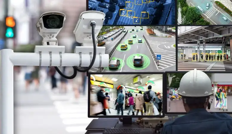
Smart cities have more cameras and sensors in place, sparking fears of mass surveillance and the (unjustified) tracking of private citizens. However, cities generally work with aggregated data and anonymize information while punishing anyone who deviates from this.
2. Data Security
Similarly, there is a concern that these systems could be hacked, disrupting critical services that people depend on and leaking sensitive data. Luckily, cities have robust cybersecurity and often have zero-trust architectures and similar innovations in their tech stacks.
3. Governance
Many also worry that these systems lack clear governance and oversight and might exhibit bias (particularly in policing heatmaps). However, smart cities can learn from open data policies and implement data trusts, while only working in council-approved ways.
Real-World Example: Virtual Singapore
Singapore is quickly aiming to become a “smart nation” rather than just a smart city. To help with this, the Singapore Land Authority launched Virtual Singapore, a digital twin of the city-state.
Launched in 2014 but completed in 2022, Virtual Singapore utilized laser scanning to accurately represent the nation’s entire landmass. It has since used this to inform local planning decisions, while integrating real-time data of buildings, population movements, infrastructure, and more.
The end result is a detailed simulation that predicts how disaster response, infrastructure plans, environmental initiatives, and other long-term strategies can fit into the Singapore of today.
Embracing Real-Time Visualization
Real-time visualization and its associated AV tools let your city finally enter a new world of tech, one that prioritizes its citizens’ convenience. The right displays and implementation strategies can ensure everything runs smoothly while also addressing people’s safety concerns.